

Herringbone Drainage System Mapping using Ground Penetrating Radar (GPR)
Problem Statement
Subsurface drainage systems, particularly herringbone layouts used in sports grounds and engineered fields, play a critical role in efficient water management and soil stability. Over time, these systems may suffer from clogging, misalignment, pipe damage, sediment accumulation, or structural deformation due to continuous usage, environmental factors, and load stresses. Traditional inspection techniques are largely invasive, disruptive to the surface, and inefficient in detecting the exact layout and condition of buried drainage networks. Hence, there is a need for a non-destructive, rapid, and high-resolution subsurface imaging technique to accurately map and assess the integrity of such drainage systems.
Overview
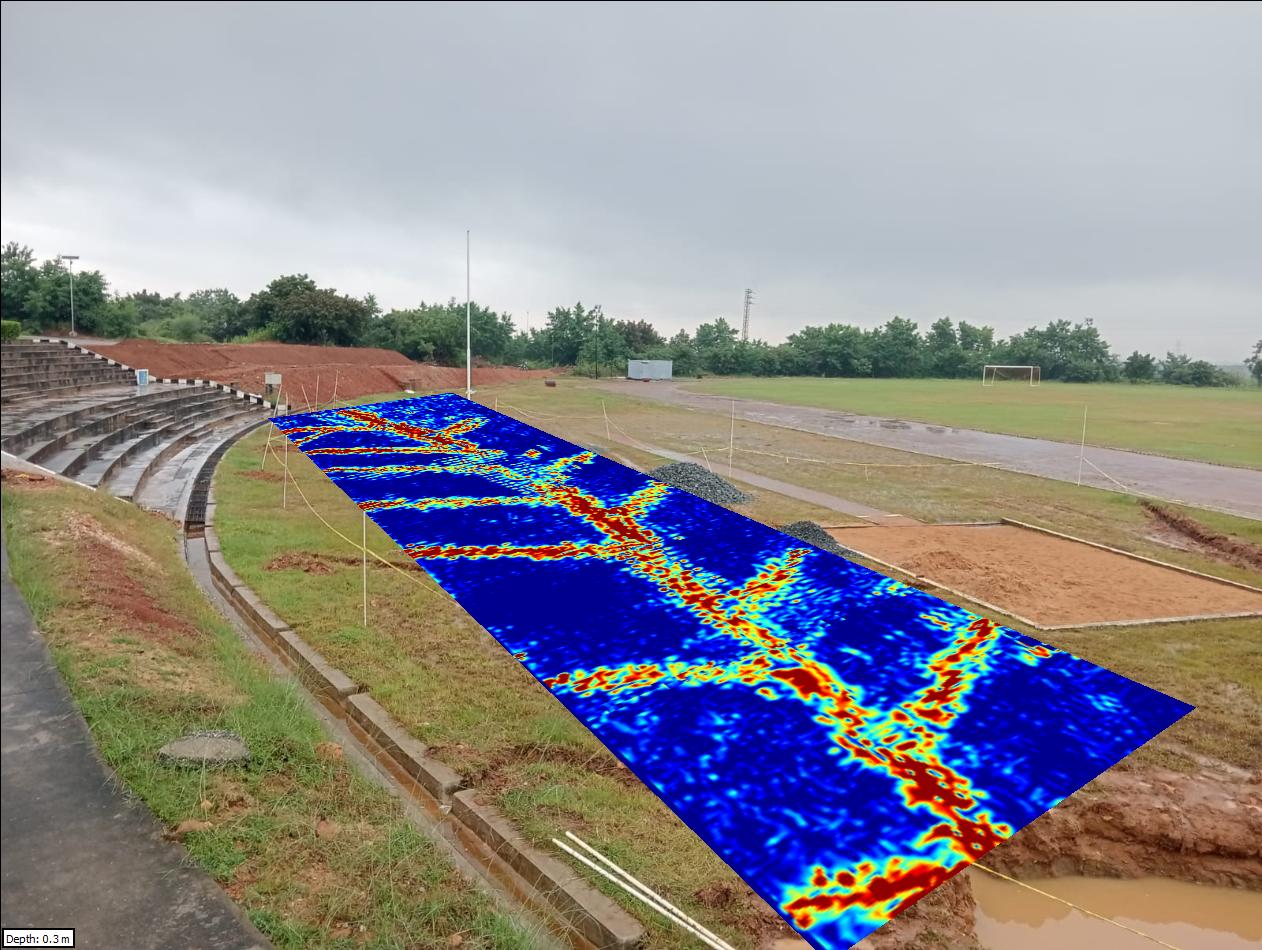
Ground Penetrating Radar (GPR) was deployed to map and assess the subsurface herringbone drainage system at the IIT Tirupati ground. The survey aimed to identify the layout, continuity, and condition of buried drainage pipes without disturbing the ground surface. A 250 MHz antenna was selected to achieve greater penetration depth while maintaining sufficient resolution for detecting drainage features.
Methodology
The GPR survey was conducted using a systematic grid-based data acquisition approach to ensure complete spatial coverage of the study area.
- Antenna Frequency: 250 MHz (optimized for deeper penetration and pipe detection)
- Survey Design: 2D parallel profiles covering the drainage field
- Data Acquisition: Continuous line scanning across the ground surface
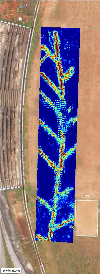
- Processing Techniques:Time-zero correction, Background removal,Gain application, 3D depth slice generation, interpretation and feature extraction
Key Findings
The processed GPR data provided valuable insights into the drainage system:
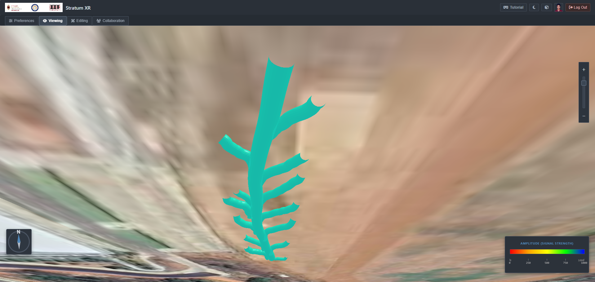
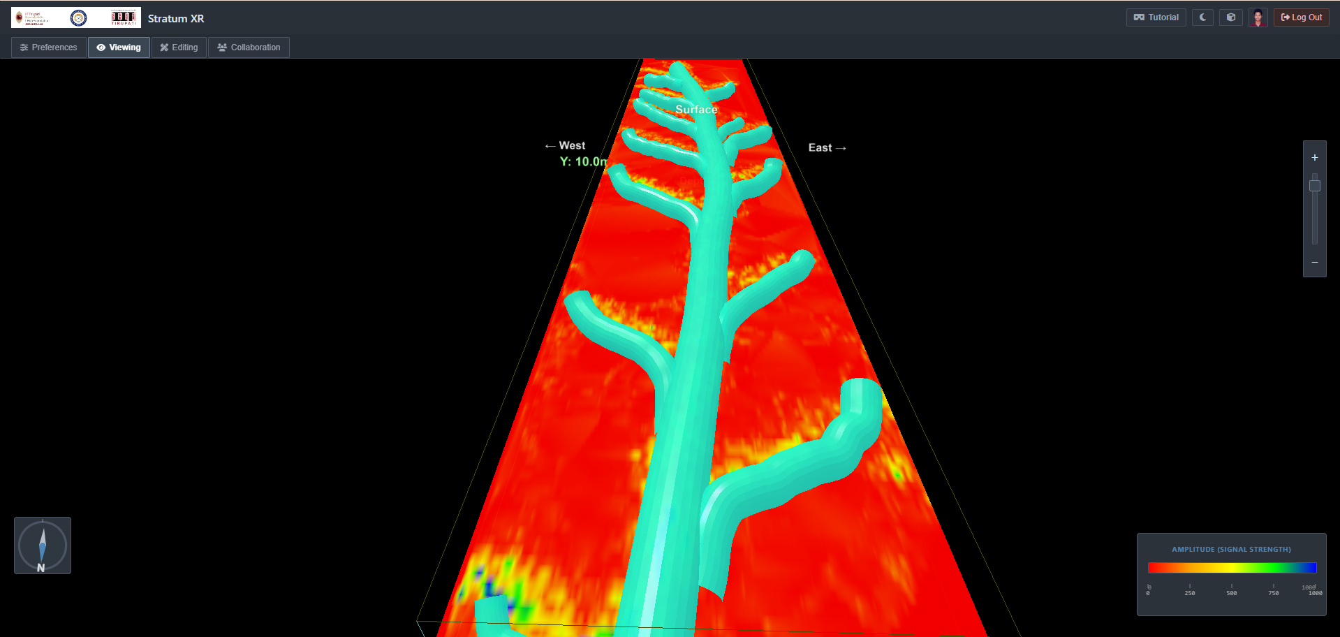
- Drainage Network Mapping: Clear identification of the herringbone pattern, including lateral and main collector pipes.
- Pipe Localization: Accurate depth estimation and spatial positioning of buried drainage pipes.
- Continuity Assessment: Detection of discontinuities or possible blockages in certain segments of the drainage network.
- Anomaly Detection: Identification of zones with weak or disrupted reflections indicating potential clogging, sediment buildup, or damage.
- Soil–Pipe Interface: Differentiation between surrounding soil and pipe boundaries, aiding in structural interpretation.
Engineering Impact
- Subsurface Infrastructure Mapping: Providing a reliable map of the drainage layout for maintenance and planning.
- Preventive Maintenance: Early detection of problem zones helps avoid waterlogging and surface damage.
- Non-Destructive Evaluation (NDE): Eliminates the need for excavation-based inspection methods.
- Performance Optimization: Ensures efficient functioning of the drainage system in sports and field applications.
Conclusion
The study demonstrates the effectiveness of 250 MHz GPR in mapping and assessing subsurface drainage systems. The ability to accurately delineate pipe networks and detect anomalies without excavation significantly enhances maintenance strategies and infrastructure management.This approach provides a reliable, fast, and non-invasive solution for monitoring drainage performance and ensuring long-term operational efficiency.
Let's Build the Future With Us
Whether you are a researcher, startup, industry partner, government organisation, academic institution, or student, IITTNiF provides opportunities to innovate, collaborate, develop technologies, and create national impact.