
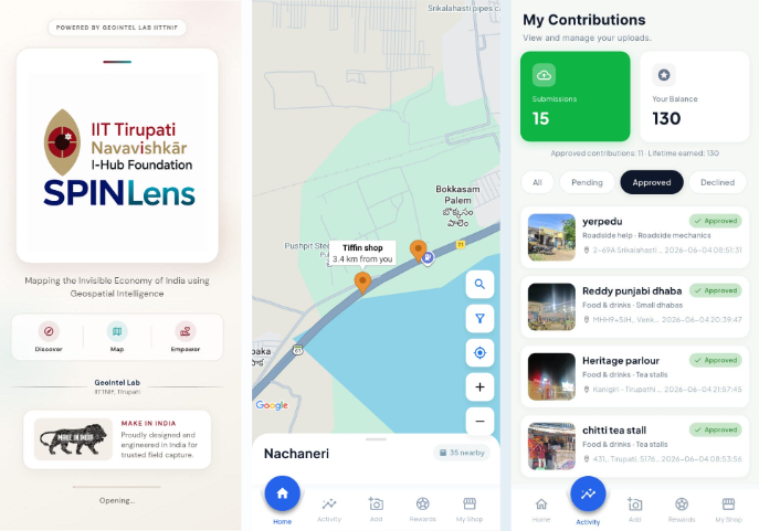
Project Overview
SPINLens is a community-powered geospatial platform designed to make underrepresented local businesses, services, and community resources more visible through collaborative mapping. The application enables users to discover places, contribute location-based information, and support the development of a more comprehensive geospatial database.
Technologies Used
- Flutter
- FastAPI
- PostgreSQL / PostGIS
- Leaflet Maps
- GPS
- AWS Cloud
- Geospatial APIs
- Spatial Analytics
- REST APIs
Problem Statement
Many local businesses, services, and community resources remain underrepresented on digital maps, limiting their discoverability and accessibility. A collaborative mapping solution can help communities contribute location information and improve the digital representation of local places.
Our Approach
Discover → Contribute → Verify
The application allows users to discover locations, submit geotagged information, categorize places, and participate in community-based verification. Geospatial databases and mapping interfaces organize location records and support location-based discovery.
Core Functionality
- Location discovery
- Geotagged data collection
- Community contributions
- Place categorization
- Information verification
- Spatial search and mapping
- Location-based insights
- Geospatial database management
Results & Impact
SPINLens aims to improve the visibility of overlooked local places and build a community-supported geospatial information network. The platform can support citizens, local businesses, researchers, planners, and decision-makers by making location information easier to discover and explore.
Target Users
- Local communities
- Small and local businesses
- Citizens and visitors
- Urban planners
- Researchers and geospatial analysts
- Community organizations
- Public-sector planning teams
Technical Challenges
Developing a scalable community-contribution and verification pipeline while maintaining the quality, consistency, and reliability of user-submitted geospatial records.
Operational Challenges
Encouraging sustained community participation, validating contributed information, and maintaining up-to-date location records across diverse geographic areas.
Let's Build the Future With Us
Whether you are a researcher, startup, industry partner, government organisation, academic institution, or student, IITTNiF provides opportunities to innovate, collaborate, develop technologies, and create national impact.