
Overview
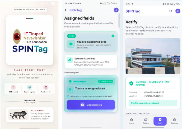
SPINTag is a geotagging application designed to transform location-based field data into reliable, verifiable digital records. By combining GPS-enabled photographic capture, location intelligence, and verification mechanisms, the application supports transparent documentation for inspections, surveys, and field operations.
Technologies Used
- Flutter
- FastAPI
- PostgreSQL
- GPS
- DigiPIN
- AWS S3
- Steganography
- Cryptographic Verification
- REST APIs
Problem Statement
Field inspections and surveys can face challenges involving inaccurate location records, inconsistent photographic documentation, and limited verification of submitted evidence. A secure geotagging solution can help improve documentation quality, traceability, and accountability in field operations.
Our Approach
Capture → Authenticate → Verify
The application captures photographs associated with geographic coordinates and location identifiers. It incorporates verification mechanisms and secure storage workflows to support the authentication, retrieval, and auditing of field documentation.
Core Functionality
- GPS-tagged photo capture
- Location intelligence integration
- DigiPIN integration
- Tamper-evident authentication and verification
- Online and offline workflow support, where implemented
- Audit trail and compliance tracking
- Secure image storage
- Field documentation management
Results & Impact
SPINTag supports reliable geospatial documentation by associating field photographs with location information and verification mechanisms. It can help streamline inspections, surveys, and compliance workflows while improving transparency and traceability.
Target Users
- Field inspection teams
- Surveyors and geospatial professionals
- Infrastructure management teams
- Government departments
- Asset management organizations
- Compliance and audit teams
- Research and monitoring organizations
Technical Challenges
Integrating location-aware mobile capture with cryptographic verification, secure image storage, and consistent record synchronization, including in field environments with limited connectivity.
Operational Challenges
Standardizing field documentation, maintaining reliable location records, and ensuring that evidence can be retrieved and verified during inspections and audits.
Images / Demonstrations
- SPINTag Mobile Application -Geotagged Photo Capture, Verification and Location Details
Let's Build the Future With Us
Whether you are a researcher, startup, industry partner, government organisation, academic institution, or student, IITTNiF provides opportunities to innovate, collaborate, develop technologies, and create national impact.