Overview
The first batch of the Subsurface Intelligence Program (SIP–GPR) was conducted from 28 to 30 January 2026 to build technical capacity among Survey of India officers in the application of Ground Penetrating Radar (GPR) for subsurface investigations. The three-day program combined expert lectures, practical demonstrations, field-based training, case studies, and hands-on data processing.
About / Background
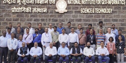
The program was jointly hosted by the National Institute for Geo-Informatics Science & Technology (NIGST), Survey of India, and the Geospatial Intelligence & Applications Laboratory, Technology Innovation Hub (TIH), IIT Tirupati. A total of 29 GDS officers from across India participated, representing diverse geological, urban, and infrastructural settings.
Key Information
The training covered the complete GPR workflow, including GPR fundamentals, electromagnetic principles, smart infrastructure applications, survey planning, system operation, calibration, field data acquisition, soil-specific signal behaviour, SUE/SUM standards, data processing, and interpretation. A dedicated field session provided hands-on experience in B-scan and C-scan GPR data acquisition using a 250 MHz antenna, including chainage marking and quality control.
Partners / Collaborators
• National Institute for Geo-Informatics Science & Technology (NIGST), Survey of India
• Geospatial Intelligence & Applications Laboratory, Technology Innovation Hub (TIH), IIT Tirupati
Highlights
• Sessions on GPR for Smart Infrastructure and Policy Frameworks, GPR theory, electromagnetic fundamentals, and underground target identification.
• Hands-on training in GPR console operation, parameter setup, calibration, data acquisition, storage, and quality control.
• Field-based B-scan and C-scan acquisition using a 250 MHz antenna, with practical training in chainage marking and survey execution.
• Guest lecture by Dr. Sakram Gugulothu, Senior Scientist, CSIR–National Geophysical Research Institute (NGRI), featuring applied GPR case studies.
• Panel discussion on “GPR for Nation Building”, focusing on infrastructure applications, standardization, GIS integration, capacity building, and inter-agency collaboration.
Outcomes / Impact
The program strengthened participants’ understanding and practical capabilities in GPR-based subsurface investigations. Participants gained experience in survey planning, system operation, field acquisition, data processing using EKKO_Project, interpretation, and standardized SUE/SUM practices. The program also enhanced awareness of GPR applications in infrastructure development, utility mapping, environmental investigations, and national asset mapping.
Additional Information
A dedicated session introduced participants to the initiatives of IIT Tirupati Navavishkar I-Hub Foundation (IITTNIF) and the Geo-Intel Lab, including their work in GIS, Remote Sensing, GNSS/NavIC, Digital Twins, spatial intelligence, and GPR applications. The program concluded with participant feedback, certificate distribution, and closing remarks emphasizing continued technical capacity building and effective deployment of GPR for national infrastructure development.