Overview
The Subsurface Intelligence Program (SIP–GPR) was conducted to build technical capacity among Survey of India officers in the application of Ground Penetrating Radar (GPR) for subsurface investigations. The 12-day program combined theoretical sessions, practical demonstrations, field-based training, hands-on data acquisition, processing, interpretation, and real-world case studies.
About / Background
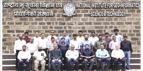
The program brought together institutional expertise in geospatial science, infrastructure intelligence, and applied research. Officers from all GDS across India participated, enabling knowledge exchange on region-specific challenges related to subsurface utility mapping, soil conditions, and infrastructure development.
Key Information
The program covered the complete GPR workflow, from electromagnetic fundamentals and survey planning to field acquisition, quality control, data processing, and interpretation. Key technical areas included antenna and parameter selection, underground target identification, Indian soil conditions, SUE/SUM standards, chainage marking, and advanced processing using Geolitix and EKKO_Project.
Partners / Collaborators
• National Institute for Geo-Informatics Science & Technology (NIGST), Survey of India
• Geospatial Intelligence & Applications Laboratory, Technology Innovation Hub (TIH), IIT Tirupati
Highlights
• Expert-led sessions on GPR theory, electromagnetic fundamentals, survey planning, and underground target identification.
• Hands-on training covering GPR console operation, calibration, field data acquisition, chainage marking, and quality control.
• Practical exposure to GPR case studies, SUE/SUM standards, Indian soil conditions, and GPR data processing and interpretation.
Outcomes / Impact
Participants strengthened their technical proficiency in GPR-based subsurface investigations, including survey design, field execution, data quality management, processing, and interpretation. The program also enhanced awareness of standardized SUE/SUM practices and demonstrated the application of GPR across infrastructure, utility mapping, reinforced concrete, pavement, and environmental investigations.
Additional Information
The program concluded with an interactive feedback session, certificate distribution, and closing remarks. The valedictory session was attended by senior representatives from IIT Tirupati, IITTNiF, and NIGST, who emphasized continued capacity building and the growing role of GPR in subsurface investigations, utility mapping, infrastructure management, and national geospatial development.