Indigenous Ground Penetrating Radar (GPR) System Development

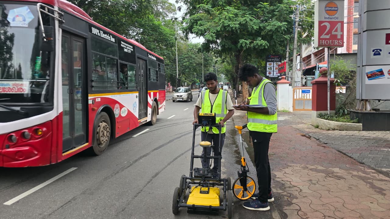
 Description: This project focuses on the development of indigenous Ground Penetrating Radar (GPR) technologies for non-destructive subsurface investigation, geological exploration and infrastructure assessment. The initiative aims to develop and integrate GPR sensors operating across multiple frequency ranges to address diverse applications, from deeper geological investigations and near-surface characterization to underground utility detection and high-resolution concrete…
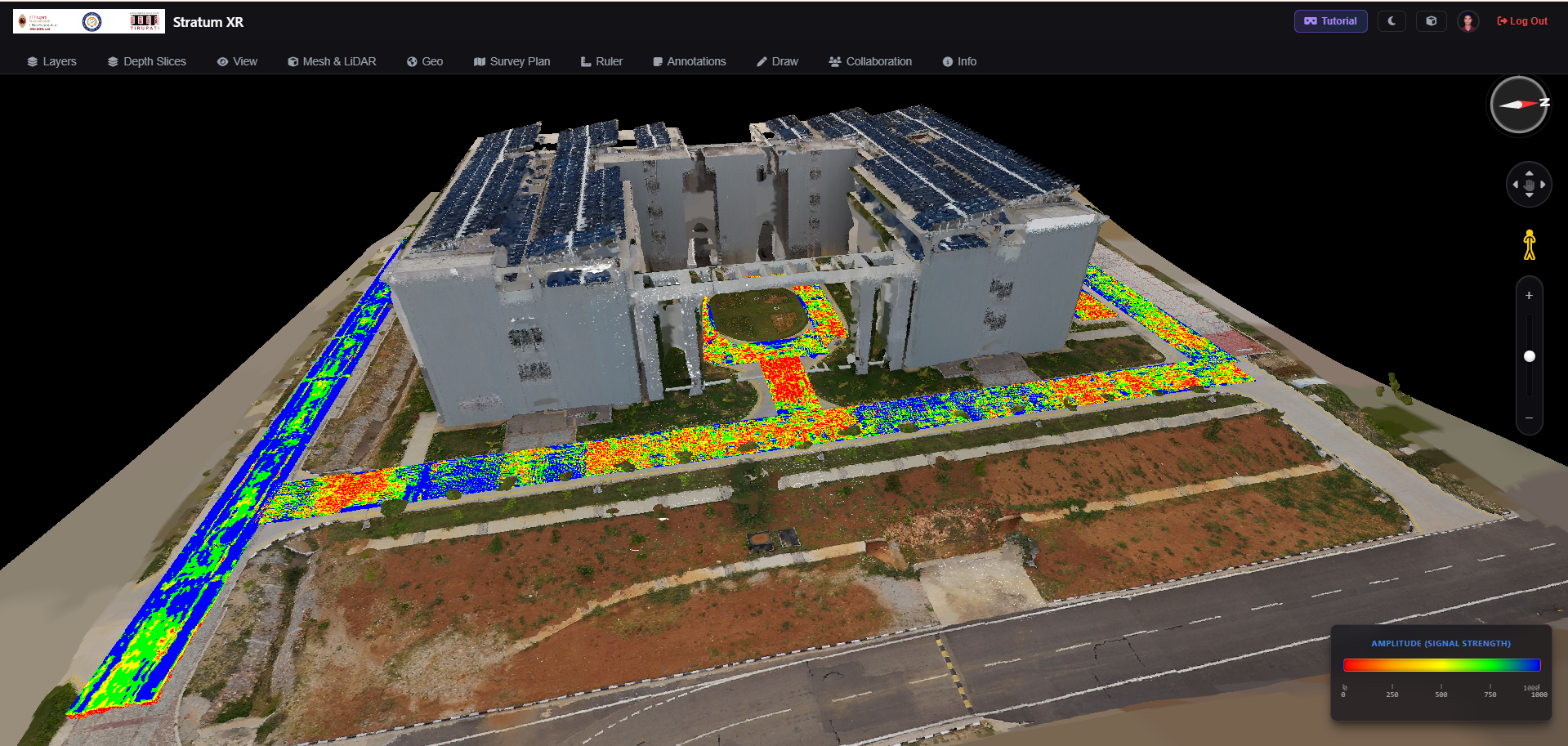
StratumXR

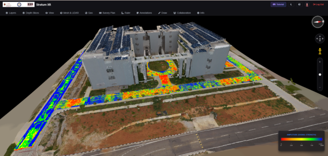
Description: StratumXR is an advanced AR/VR-enabled geospatial technology platform being developed to transform the planning, execution, visualization and quality control of geophysical surveys and remote sensing operations. The platform aims to integrate subsurface and other spatial datasets into immersive 3D environments, enabling users to visualize survey layouts, interpret subsurface features, review field data and improve…

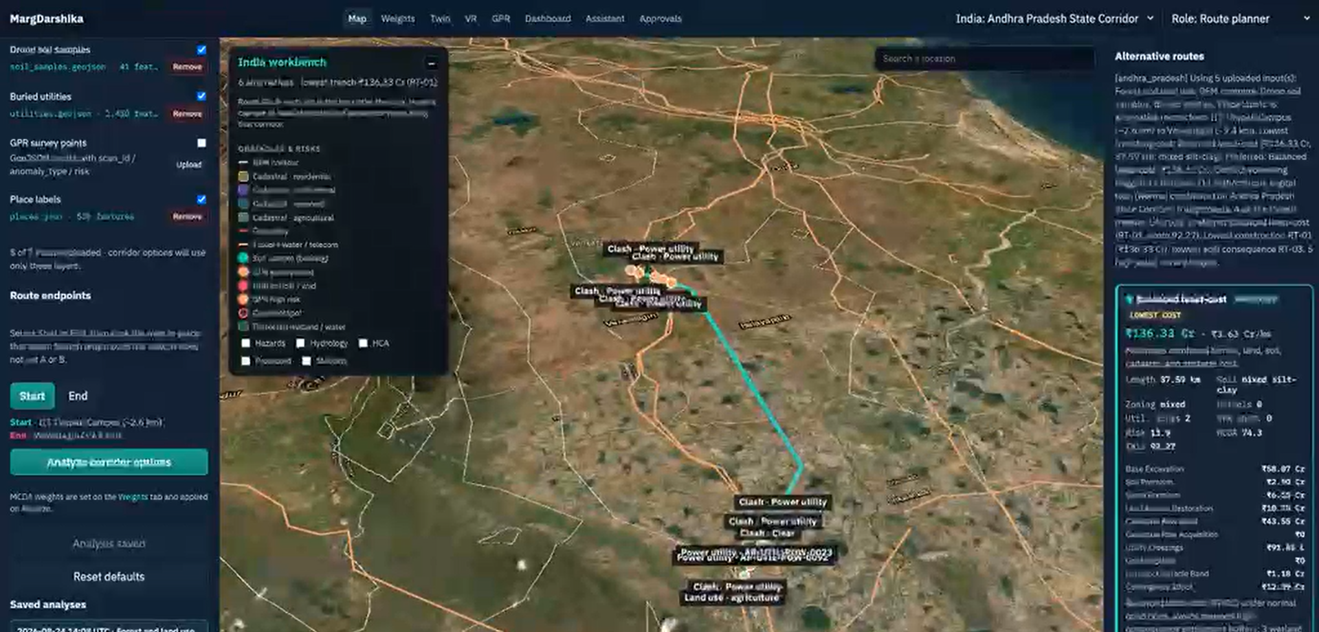
MargDarshika – Geospatial Route Optimization and Intelligent Pipeline Planning Platform

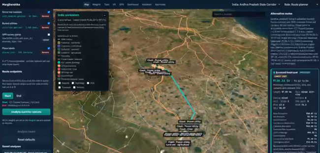
Description: MargDarshika is a collaborative technology development initiative between IITTNiF and Exafluence focused on developing a geospatial intelligence platform for route optimization and pipeline-related planning. The project integrates geospatial modelling, spatial analysis, survey expertise, route validation and user-centric workflow design to support informed infrastructure planning and decision-making. Status: In Development – Initial product development is…

Ground Penetrating Radar (GPR)-Based Subsurface Utility Mapping for Kerala Water Authority (KWA)

Description: This project involves the application of Ground Penetrating Radar (GPR) technology for non-invasive subsurface investigation and underground utility mapping to support water infrastructure assessment and planning. The work includes field data acquisition using GPR, DGPS-based positioning, raw and processed data analysis, utility identification, and preparation of interpreted utility maps and technical drawings. The project…

QHills Technology Pvt Ltd

QHills Technology Pvt Ltd Technology Readiness Level (TRL): TRL 6 Stage (Idea / MVP / Early Revenue / Growth): MVP At QHills, we specialize in delivering software development for business needs. Our core offerings include custom software solutions, web application development, mobile app development, AI/ML integration. We also provide digital transformation services that enable businesses…

Bhoomicam Pvt Ltd

Bhoomicam Pvt Ltd Technology Readiness Level (TRL): 8 Stage (Idea / MVP / Early Revenue / Growth): Early Revenue Bhoomicam is transforming Indian agriculture with AI-powered geospatial intelligence and satellite technology. Its platform delivers data-driven insights to help farmers, agribusinesses, and financial organizations optimize resource use, improve production, and manage risks. BhoomiCrop Analytics, the core…

Navariti Innovation Pvt Ltd

Navariti Innovation Pvt Ltd Technology Readiness Level (TRL): TRL 8 Stage (Idea / MVP / Early Revenue / Growth): Growth Navariti Innovation Pvt Ltd is an AIoT-driven climate-tech startup focused on transforming agriculture and environmental monitoring through smart, data-driven solutions. Through its flagship platform HELIOT.AI, the company integrates AI, IoT, and solar technologies to empower…

Operation Dronagiri: revolutionising geospatial innovation for national development

IITTNiF has launched Operation Dronagiri — a landmark initiative that harnesses the power of drone-based geospatial intelligence to accelerate progress across precision agriculture, disaster response, urban planning, and land administration. The programme brings together IITTNiF’s GNSS, GIS, and AI/ML labs in a coordinated effort with government and industry partners.