
SPINTrip – Web and Mobile Application

Project Overview   SPINTrip is an intelligent tourism platform that integrates attractions, tourism information, routes, accommodation, weather, and trip-planning features into a single platform. It helps visitors explore destinations, plan personalized trips, discover nearby places, and access travel-related information, particularly around the Tirupati region. Problem Statement Travelers visiting Tirupati and Tirumala face a fragmented experience, relying…
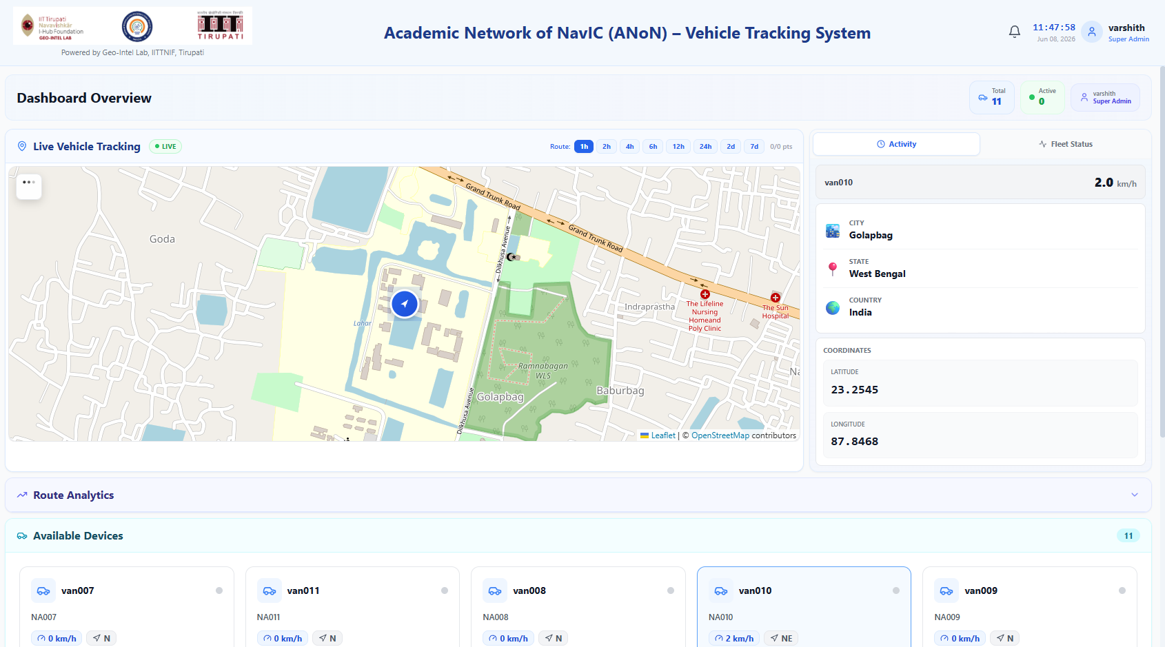
Academic Network of NavIC (ANoN) Vehicle Tracking System

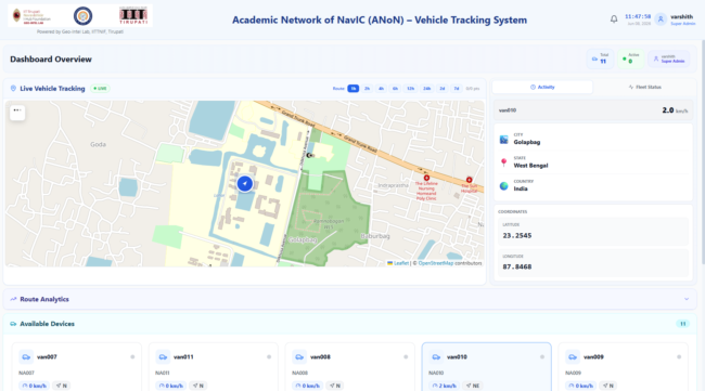
Project Overview The Academic Network of NavIC (ANoN) Vehicle Tracking System is a real-time vehicle monitoring platform designed to visualize vehicle locations and process positioning telemetry through geospatial dashboards. By integrating NavIC/GNSS positioning, live map visualization, and real-time communication, the platform supports fleet monitoring and mobility analysis. Technologies Used React FastAPI PostgreSQL Redis WebSockets Leaflet…

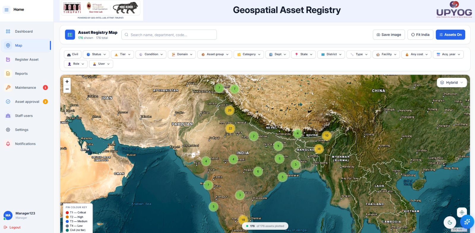
 Asset Management System

Project Overview The Asset Management System is a centralized digital platform for registering, mapping, monitoring, and managing organizational assets throughout their lifecycle. By combining GIS capabilities, location intelligence, and administrative workflows, the platform supports improved asset visibility, maintenance planning, and operational accountability. Technologies Used React FastAPI PostgreSQL / PostGIS DigiPIN GIS & Mapping Services AWS…

Property Tax Assessment & Payment Management System

Project Overview The Property Tax Assessment & Payment Management System is a digital governance platform designed to streamline property registration, GIS-based mapping, tax assessment, and online payment workflows. It integrates field verification, geospatial intelligence, and administrative dashboards to support transparent and efficient property tax management. Technologies Used Flutter React FastAPI PostgreSQL / PostGIS GIS &…

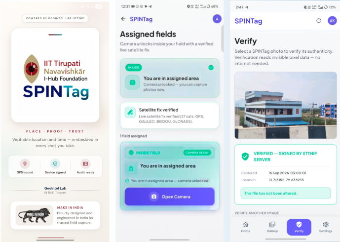
SPINTag Mobile Application

Playstore Appstore Overview SPINTag is a geotagging application designed to transform location-based field data into reliable, verifiable digital records. By combining GPS-enabled photographic capture, location intelligence, and verification mechanisms, the application supports transparent documentation for inspections, surveys, and field operations. Technologies Used Flutter FastAPI PostgreSQL GPS DigiPIN AWS S3 Steganography Cryptographic Verification REST APIs Problem…

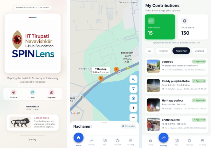
SPINLens Mobile Application

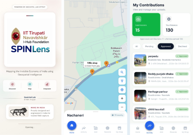
Playstore Project Overview SPINLens is a community-powered geospatial platform designed to make underrepresented local businesses, services, and community resources more visible through collaborative mapping. The application enables users to discover places, contribute location-based information, and support the development of a more comprehensive geospatial database. Technologies Used Flutter FastAPI PostgreSQL / PostGIS Leaflet Maps GPS AWS…

 3D Digital Twin

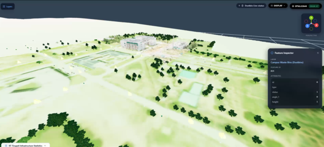
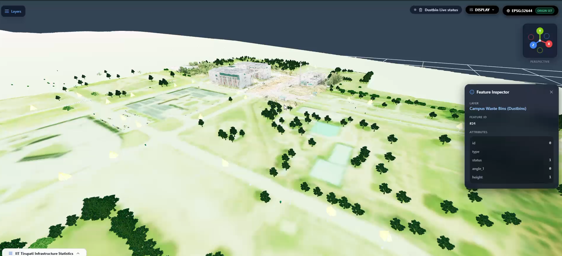
 Summary: Integrates LiDAR data, 3D models, and GIS asset layers to create a digital representation of real-world infrastructure for visualization, monitoring, and spatial analysis. Detailed Description: The project focuses on developing a 3D digital twin of infrastructure by integrating terrestrial LiDAR point clouds, 3D mesh models, and GIS datasets. The workflow includes point cloud cleaning…

Geo Explorer – GIS-Based 3D Digital Twin Visualization

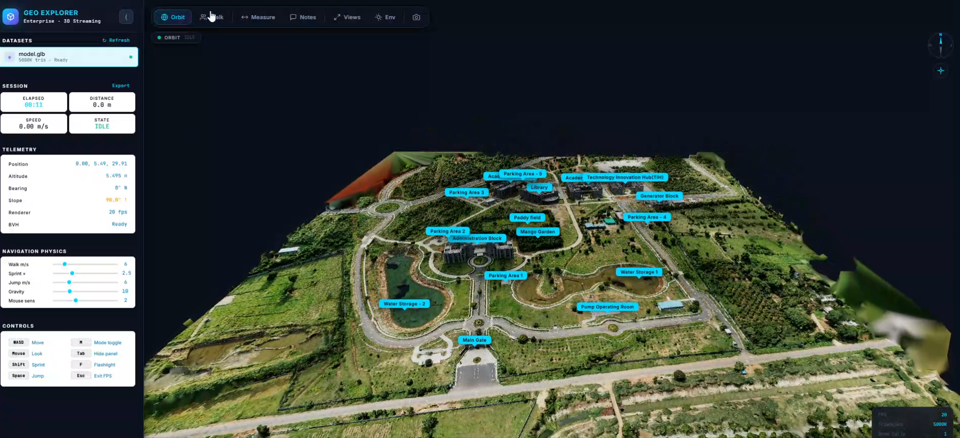
 Summary: Developed a geospatial visualization platform integrating 3D mesh models and GIS assets to explore and visualize real-world infrastructure in an interactive digital environment. Detailed Description: Geo Explorer focuses on visualizing real-world infrastructure through an interactive 3D digital environment. The project integrates processed LiDAR point clouds, 3D mesh models, and GIS asset data to represent…

LiDAR-Based Powerline Sag Analysis

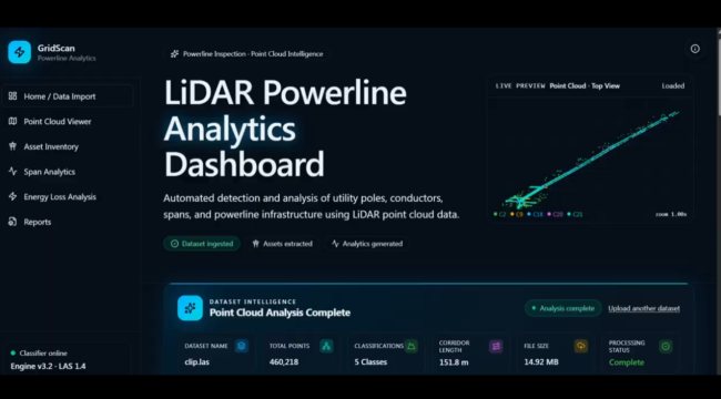
Summary: Analyzed powerline geometry and conductor sag using LiDAR data to assess wire curvature, ground clearance, and potential electrical safety risks. Detailed Description: This project focuses on analyzing overhead power transmission lines using LiDAR point cloud data and geospatial processing techniques. The workflow involves identifying and analyzing powerline conductors, extracting their spatial coordinates, and assessing…

 Predictive Digital Twin

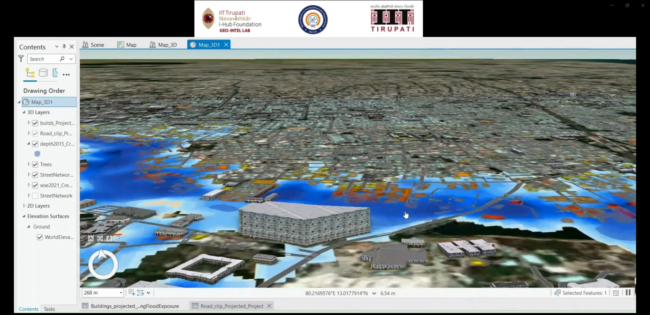
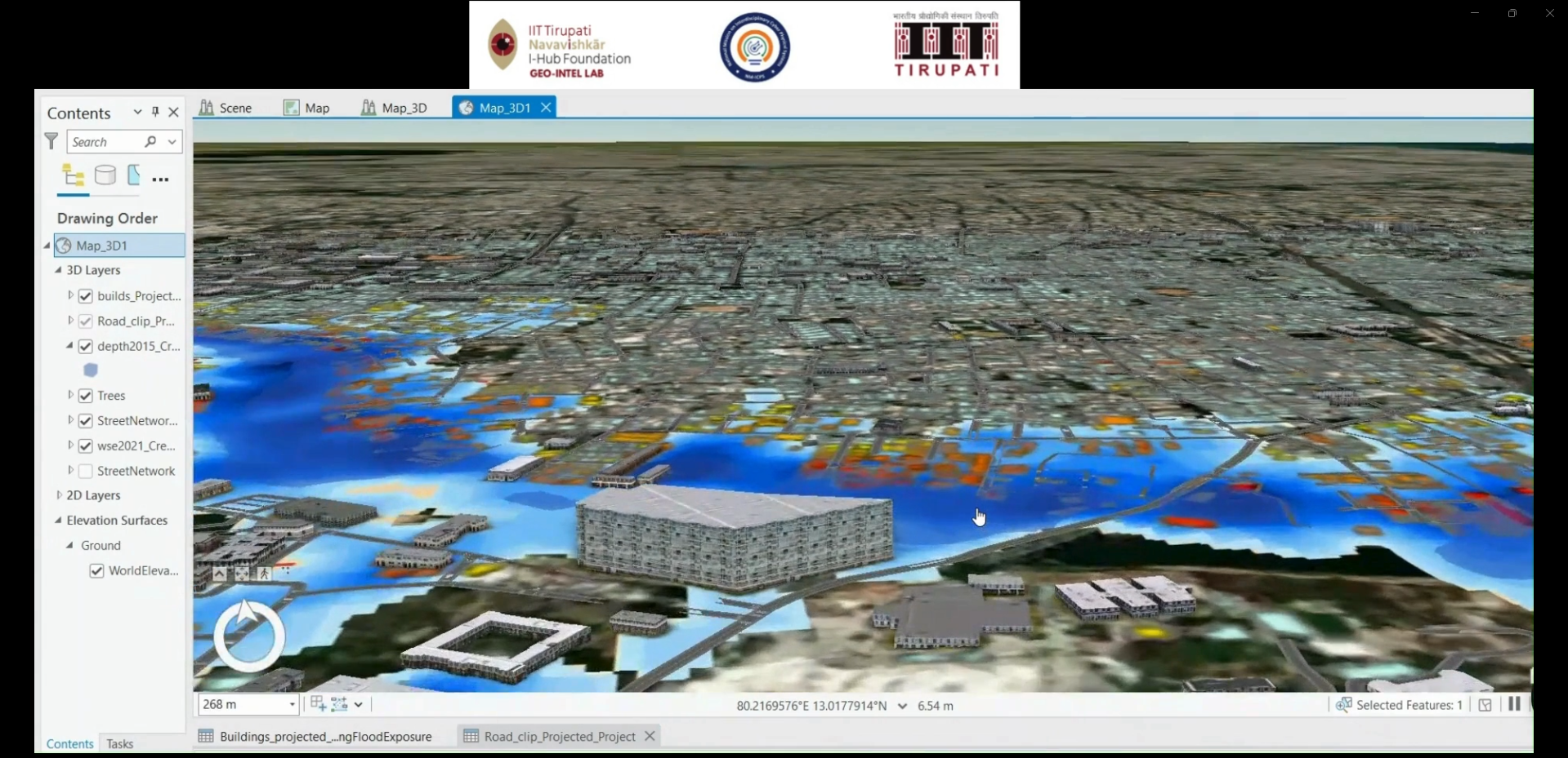
 Integrates GIS, 3D digital twin technology, and predictive analytics to visualize infrastructure assets and support data-driven planning and decision-making. Detailed Description: The project focuses on developing a digital representation of real-world infrastructure by integrating geospatial data, 3D models, and spatial information. It aims to support infrastructure visualization, condition monitoring, scenario analysis, and predictive planning through…