SPINGeoLLM 

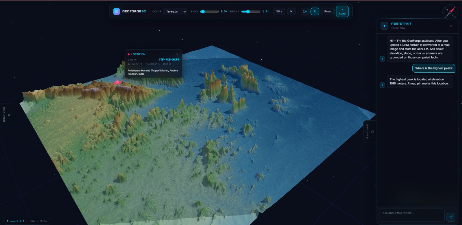
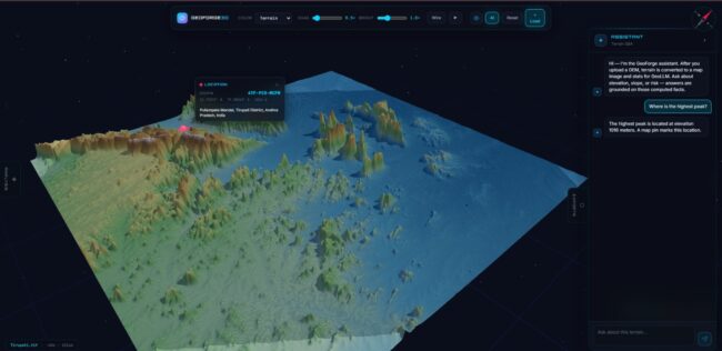
Project Overview –GeoLLM.jpeg A browser-based geospatial intelligence platform that combines interactive 3D terrain visualization, DEM-based geospatial processing, Earth Observation foundation models, deep learning-based terrain segmentation and Large Language Models (LLMs). The platform enables users to upload and explore DEM data, visualize terrain in 3D, perform terrain analysis, classify terrain characteristics using the Prithvi-EO-2.0 foundation model…
SPINOrbit — Satellite Tracking & Intelligence Platform

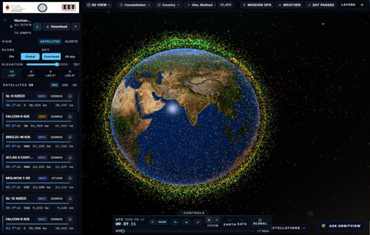
SPINOrbit — Satellite Tracking & Intelligence PlatformProject Overview: A GIS- and space-enabled intelligence platform designed to support live satellite tracking, orbital pass prediction, India-focused weather and flood intelligence, disaster context, launch monitoring, and space-weather awareness in one operational console. Problem Statement: Traditional space and disaster workflows often rely on separate tools for satellite catalogs, pass…

AI-Enabled Multi-Modal Object Detection Platform

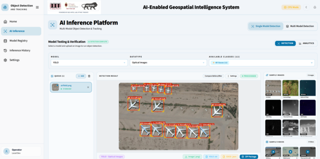
Project Overview AEGIS is a multi-modal computer vision platform designed to process optical (RGB), Synthetic Aperture Radar (SAR), and thermal/infrared imagery through a centralized detection and analysis dashboard. It integrates multiple deep-learning models for object detection, classification, instance segmentation, and video tracking, enabling users to compare model outputs, monitor inference performance, and visualize detected objects…

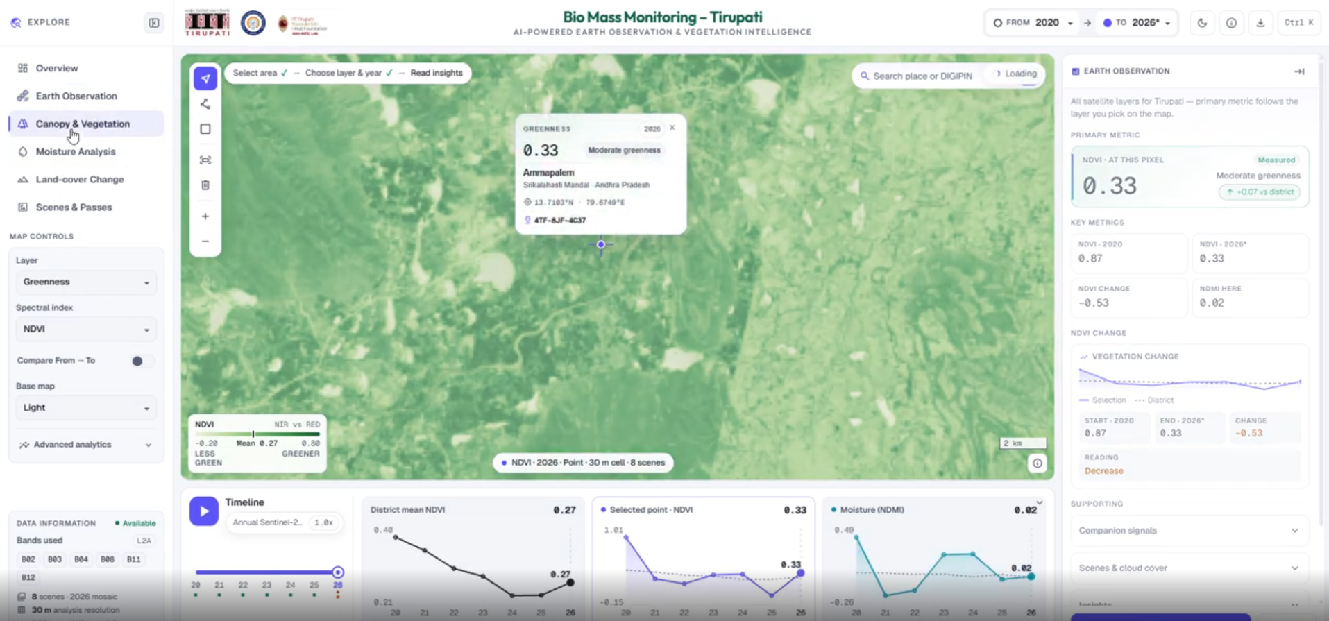
AGB–Prithvi: Above-Ground Biomass Estimation & Monitoring System

Project Overview The AGB–Prithvi System is a satellite-based geospatial intelligence platform designed to analyze vegetation patterns and support above-ground biomass (AGB) estimation using Earth observation data and foundation-model representations. The workflow integrates Sentinel-2 satellite imagery from Microsoft Planetary Computer, the Prithvi-EO-2.0 foundation model, GEDI biomass reference data, and machine learning regression to support spatial analysis,…

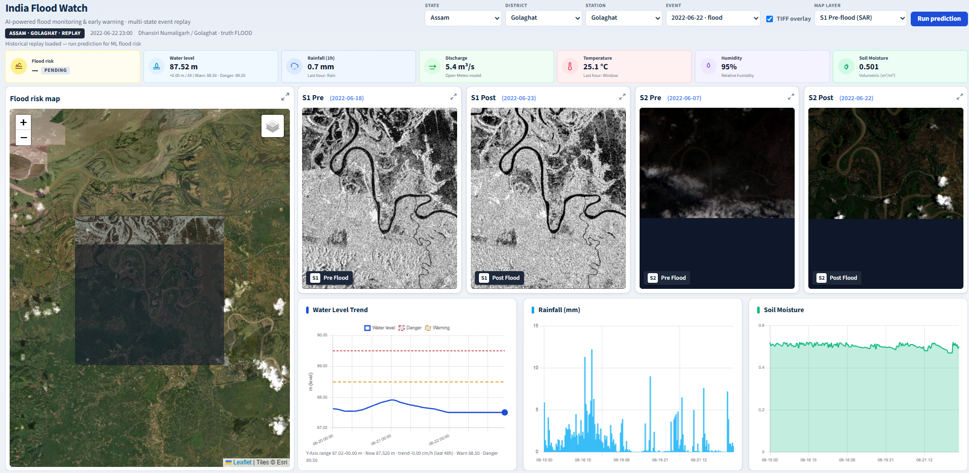
Flood Monitoring & Prediction System

Project Overview The Flood Monitoring & Prediction System is an AI-enabled geospatial platform that integrates satellite imagery, hydro-meteorological observations, and machine learning to support flood-risk assessment and inundation monitoring. By combining Sentinel-1 Synthetic Aperture Radar (SAR), Sentinel-2 multispectral imagery, and environmental sensor data, the platform enables water-extent change detection, flood-risk analysis, and data-driven early-warning support.…

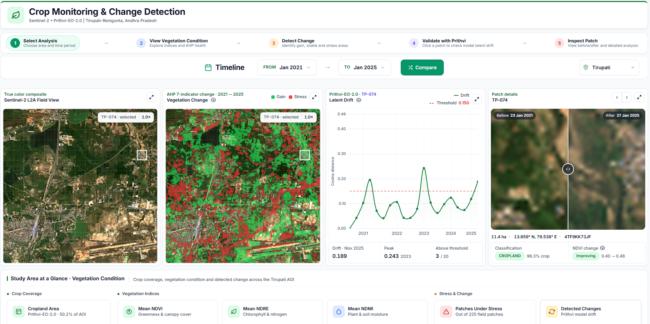
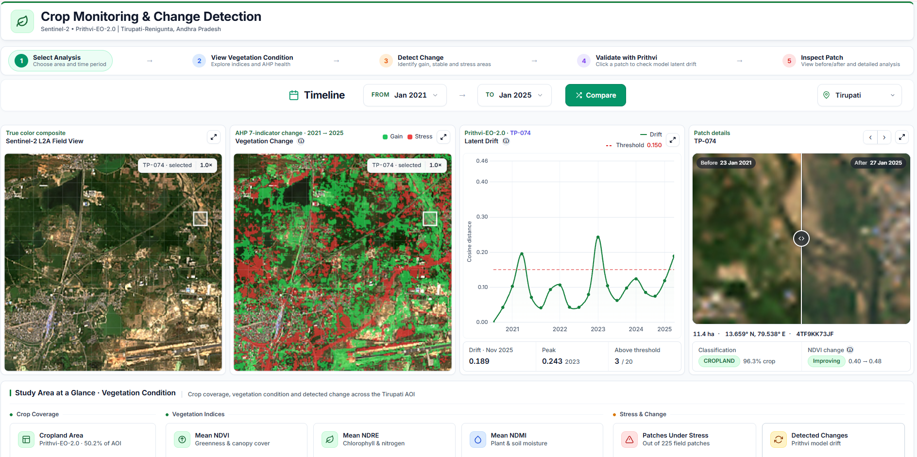
Crop Monitoring & Change Detection System

Project Overview The Crop Monitoring & Change Detection System is a satellite-based geospatial intelligence platform designed to monitor vegetation health, identify potential land-cover changes, and assess agricultural conditions over time. By integrating multi-temporal Sentinel-2 imagery, the Prithvi-EO-2.0 Earth observation foundation model, vegetation indices, and Analytic Hierarchy Process (AHP)-based assessment, the platform provides spatial and temporal…

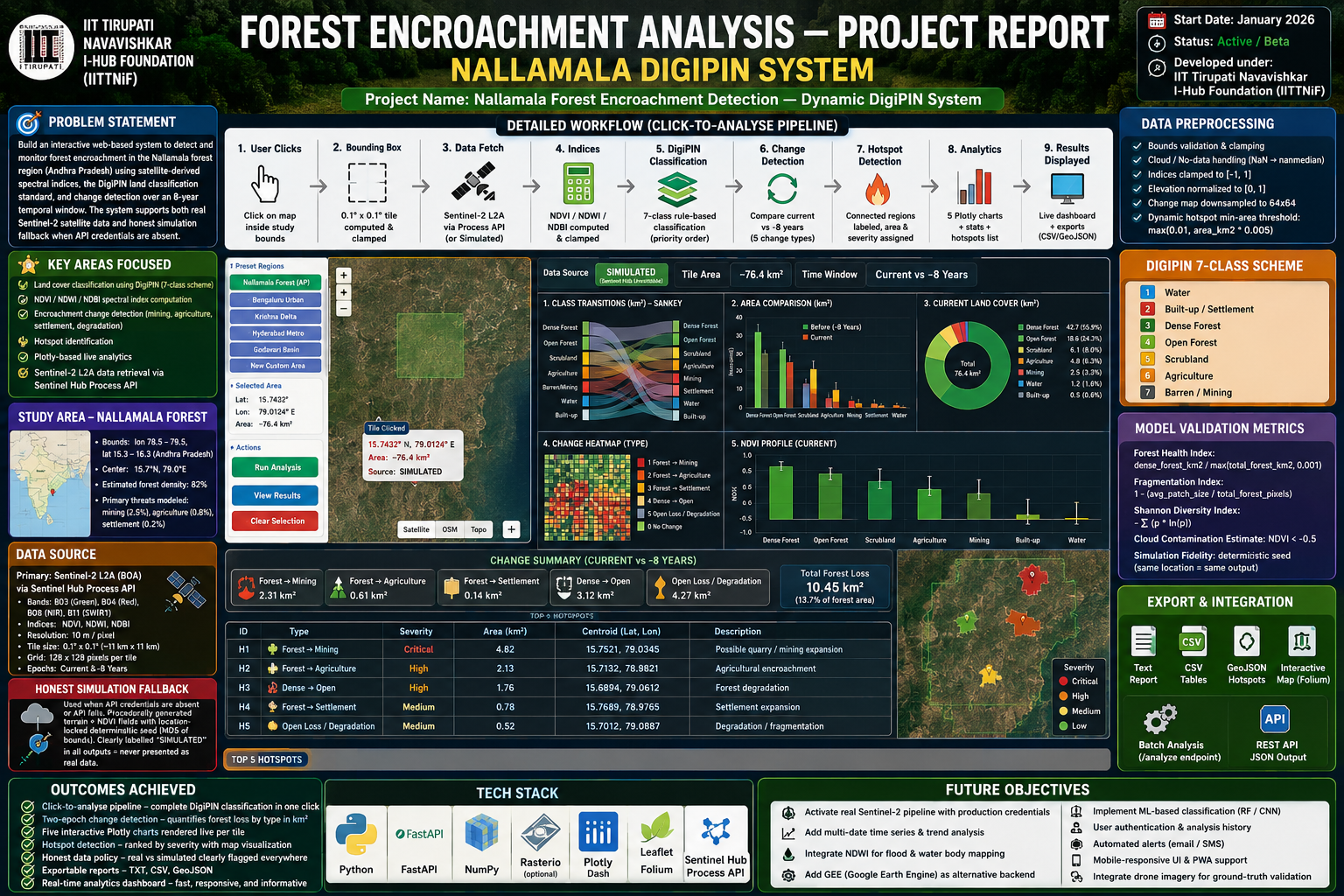
 Forest Encroachment Monitoring System

Project Overview The Forest Encroachment Monitoring System uses satellite imagery and geospatial analysis to support the identification and monitoring of forest-cover changes. By processing multi-temporal Landsat and Sentinel-2 data, the platform supports the analysis of potential forest loss, land-cover changes, and vegetation trends for environmental monitoring. Technologies Used Python Flask HTML CSS JavaScript Landsat Data…

SPINTrip – Web and Mobile Application

Project Overview   SPINTrip is an intelligent tourism platform that integrates attractions, tourism information, routes, accommodation, weather, and trip-planning features into a single platform. It helps visitors explore destinations, plan personalized trips, discover nearby places, and access travel-related information, particularly around the Tirupati region. Problem Statement Travelers visiting Tirupati and Tirumala face a fragmented experience, relying…

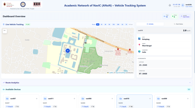
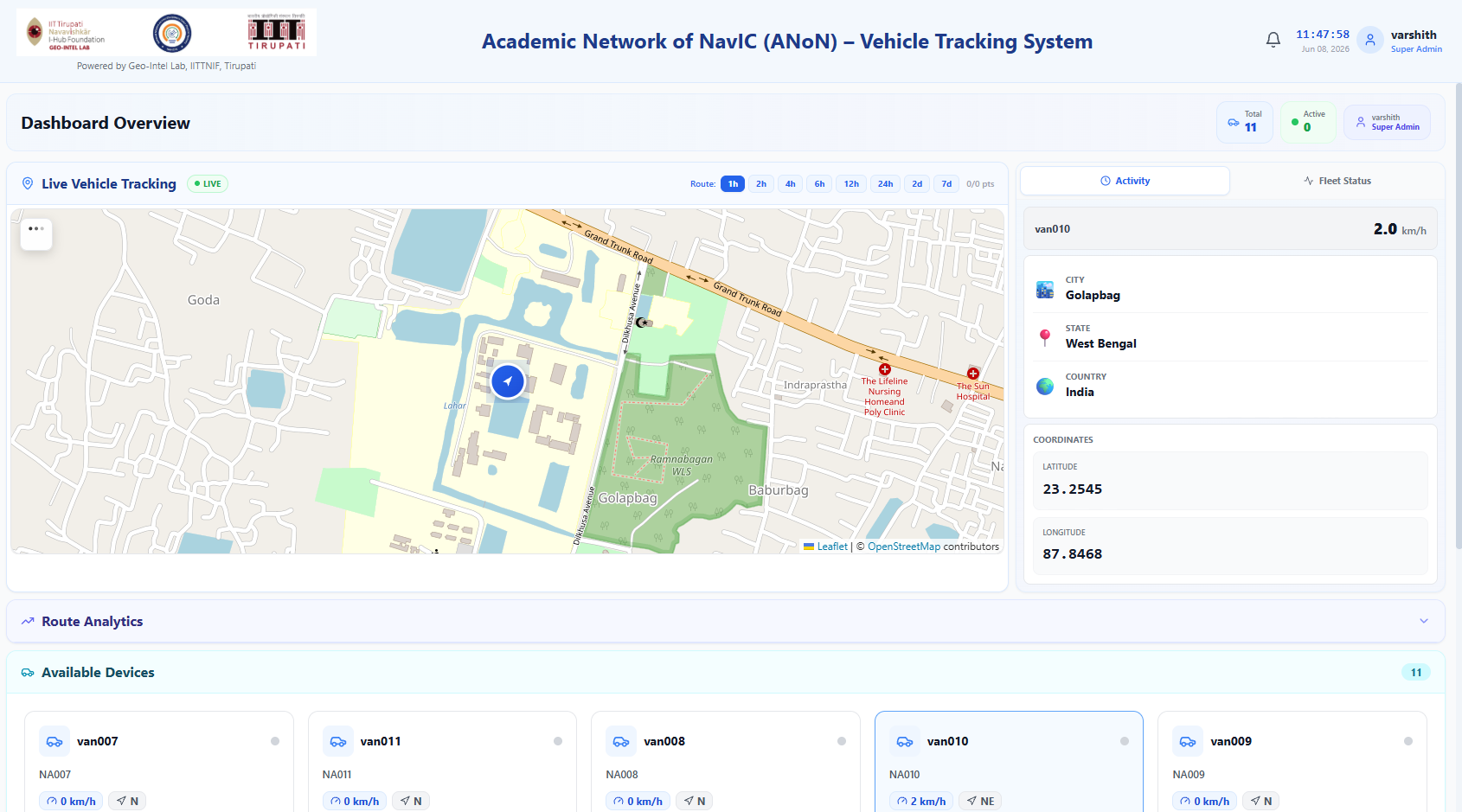
Academic Network of NavIC (ANoN) Vehicle Tracking System

Project Overview The Academic Network of NavIC (ANoN) Vehicle Tracking System is a real-time vehicle monitoring platform designed to visualize vehicle locations and process positioning telemetry through geospatial dashboards. By integrating NavIC/GNSS positioning, live map visualization, and real-time communication, the platform supports fleet monitoring and mobility analysis. Technologies Used React FastAPI PostgreSQL Redis WebSockets Leaflet…

 Asset Management System

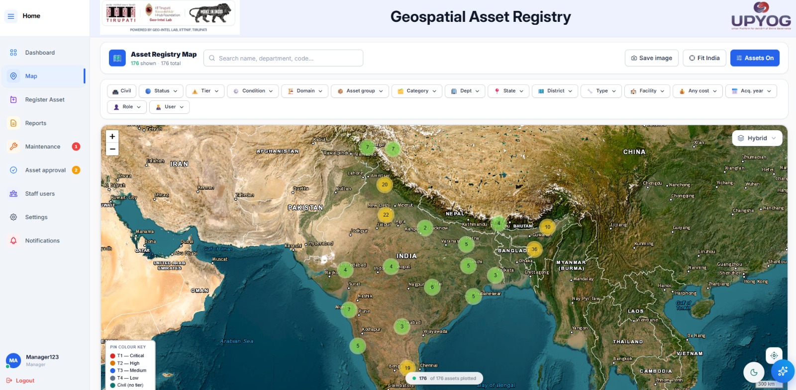
Project Overview The Asset Management System is a centralized digital platform for registering, mapping, monitoring, and managing organizational assets throughout their lifecycle. By combining GIS capabilities, location intelligence, and administrative workflows, the platform supports improved asset visibility, maintenance planning, and operational accountability. Technologies Used React FastAPI PostgreSQL / PostGIS DigiPIN GIS & Mapping Services AWS…