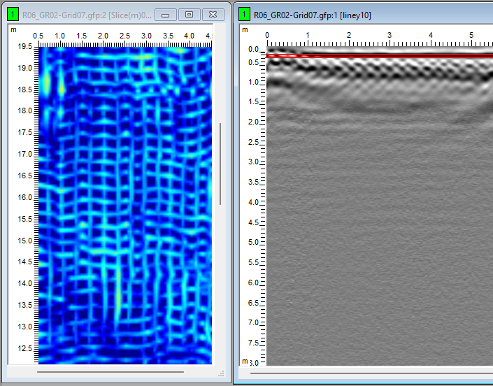
Detection and Mapping of Manholes and Underground Chambers Problem Statement

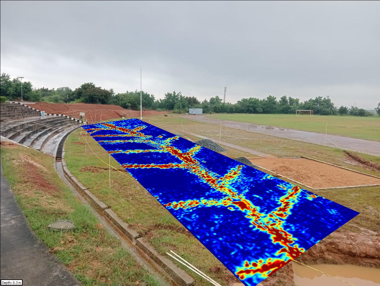
Herringbone Drainage System Mapping using Ground Penetrating Radar (GPR) Problem Statement Subsurface drainage systems, particularly herringbone layouts used in sports grounds and engineered fields, play a critical role in efficient water management and soil stability. Over time, these systems may suffer from clogging, misalignment, pipe damage, sediment accumulation, or structural deformation due to continuous usage,…
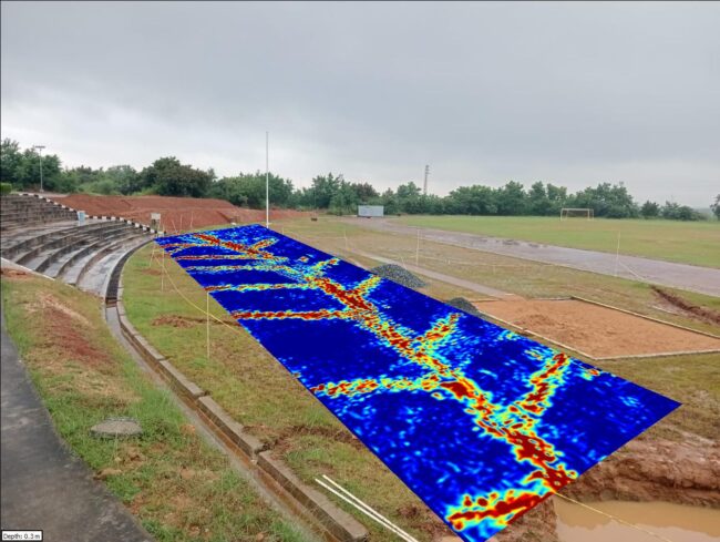
Herringbone Drainage System Mapping using Ground Penetrating Radar (GPR)

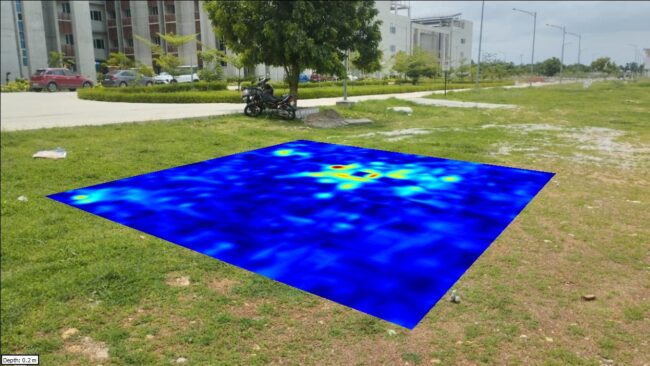
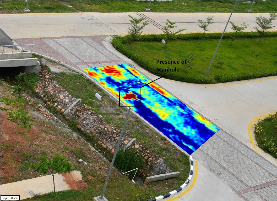
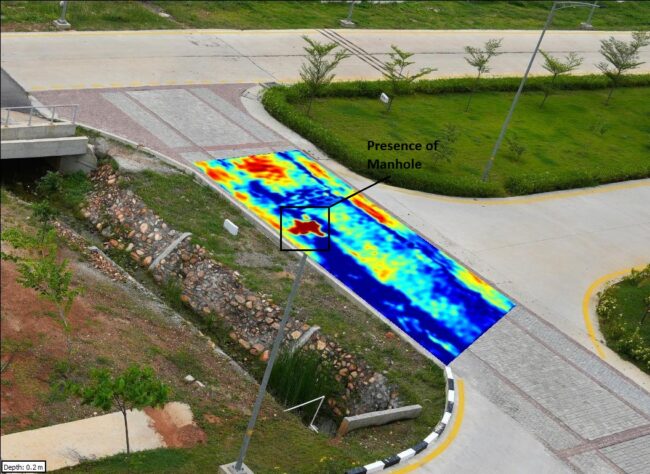
Detection and Mapping of Manholes and Underground Chambers Problem Statement Underground manholes and inspection chambers are vital for drainage, utility access, and maintenance. However, their depth, extent, and connectivity are often poorly documented, posing risks during construction, retrofitting, or urban expansion. Conventional intrusive methods are disruptive, whereas a non-destructive, high-resolution approach is essential for safe…

Detection of Utilities Beneath Rebar Mesh using GPR

Problem Statement Optical Fiber Cables (OFCs) form the backbone of digital connectivity, but their non-metallic composition and installation within plastic conduits make them extremely difficult to detect with conventional geophysical tools. In wet soil conditions, where radar signal attenuation is high, mapping such cables becomes even more challenging. A non-destructive technique was required to attempt…

GPR Survey for Optical Fiber Cable (OFC) Detection in Wet Soil Conditions

Problem Statement Optical Fiber Cables (OFCs) form the backbone of digital connectivity, but their non-metallic composition and installation within plastic conduits make them extremely difficult to detect with conventional geophysical tools. In wet soil conditions, where radar signal attenuation is high, mapping such cables becomes even more challenging. A non-destructive technique was required to attempt…

Indoor GPR Survey for Utility Detection and Subsurface Mapping

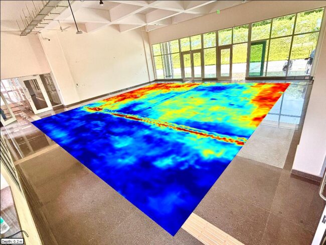
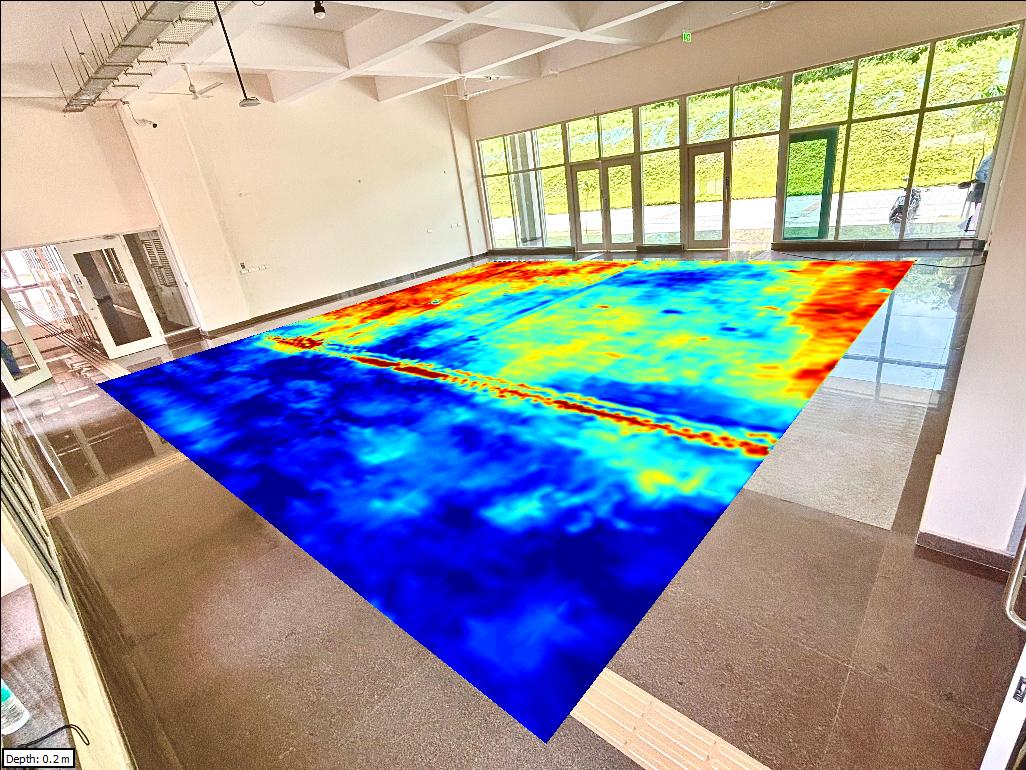
Problem Statement Indoor environments often host a complex network of utilities and conduits, which are frequently undocumented or poorly mapped. During infrastructure modifications or renovation, the risk of damaging hidden services such as electrical lines, water pipes, or communication ducts is high, leading to costly repairs and operational downtime. Additionally, understanding subsurface soil variability beneath…

Hidden cracks in Roads using GPR

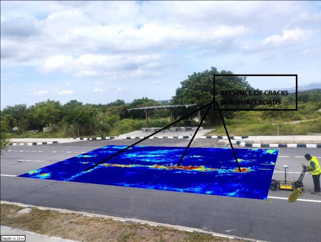
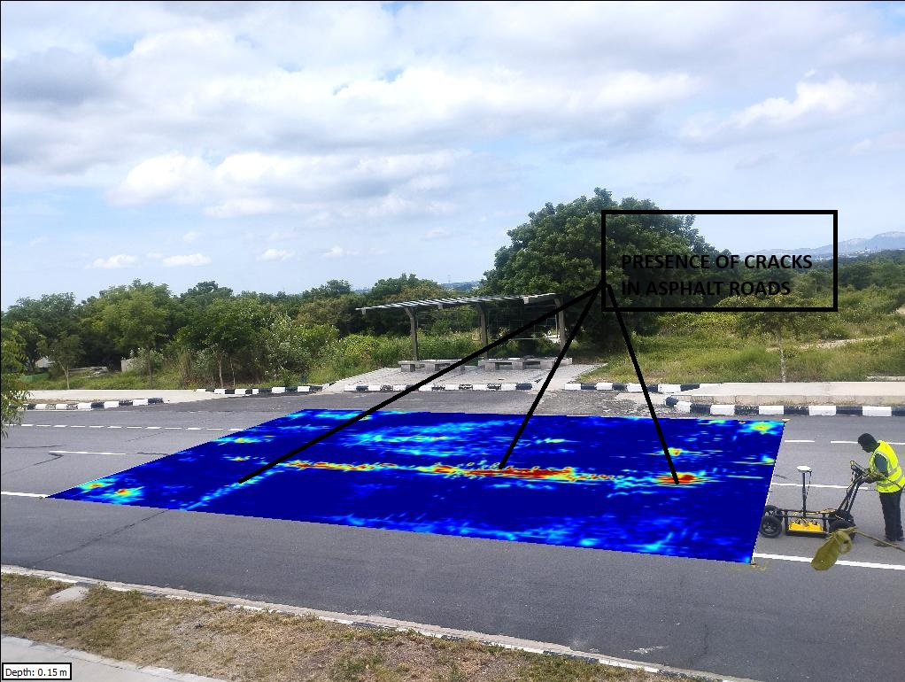
Problem Statement Road durability depends on the integrity of subsurface layers and uniform compaction beneath the asphalt. Conventional inspection methods often miss hidden discontinuities and early signs of soil subsidence, which later lead to cracks and structural failures. A non-destructive, high-resolution survey was required to detect hidden joints, subsurface discontinuities, and potential zones of weakness…

Rebar Spacing Mapping to Select Safe Core-Cutting Location using GPR

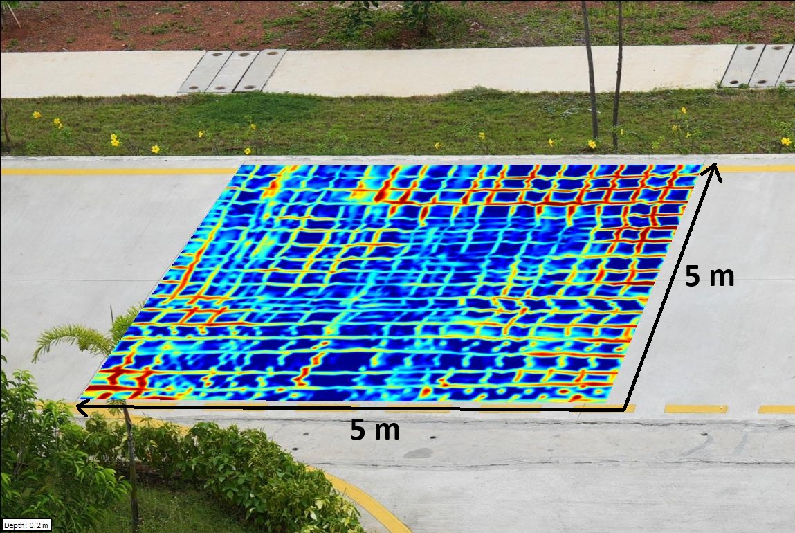
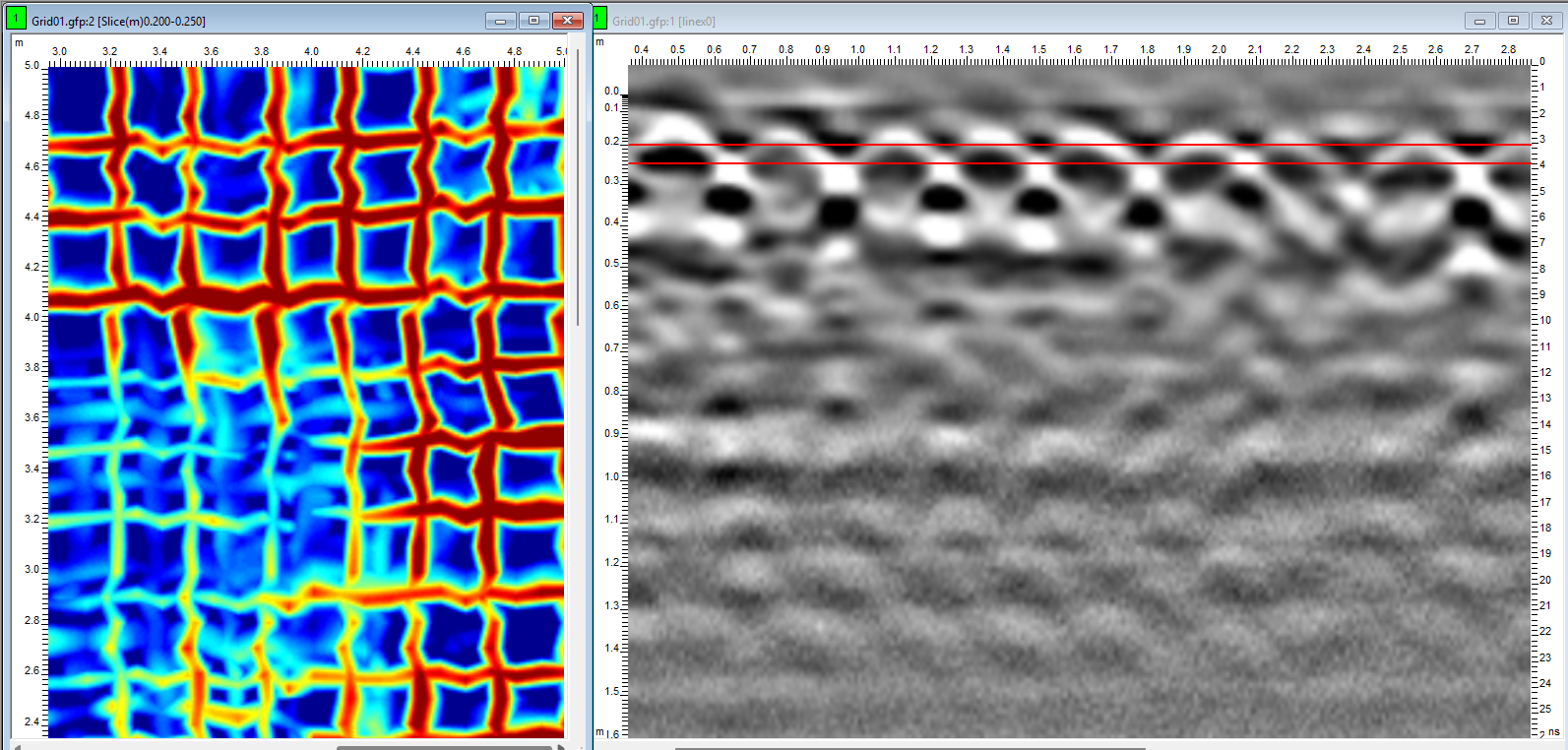
Problem Statement Coring through reinforced concrete requires precise avoidance of reinforcement, tendons, and embedded services. Inadequate targeting risks structural damage, costly repairs, and safety incidents. A non-destructive, high-resolution method was needed to quantify rebar spacing, cover depth, and bar layout to define a safe coring window.   Overview A high-frequency UWB GPR survey (≈500 MHz…

Detection of Rebar Misalignments in Reinforced Concrete using GPR

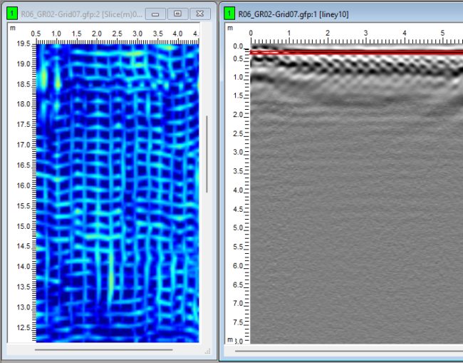
Problem Statement The performance and durability of reinforced concrete structures depend heavily on the correct placement and alignment of rebar meshes. Misalignments, improper spacing, or cover variations can compromise load-bearing capacity and accelerate deterioration through corrosion. Conventional inspection methods such as coring are destructive and limited in scope, necessitating a non-destructive, high-resolution technique for rebar…

Asphalt Thickness Measurement over Concrete using GPR

Problem Statement In transportation and pavement engineering, accurate knowledge of asphalt overlay thickness is essential for structural capacity assessment, maintenance planning, and rehabilitation design. Traditional coring is destructive and provides only point-specific data. A non-destructive, high-resolution solution was required to evaluate the asphalt layer and underlying concrete slab, along with potential anomalies at their interface.…

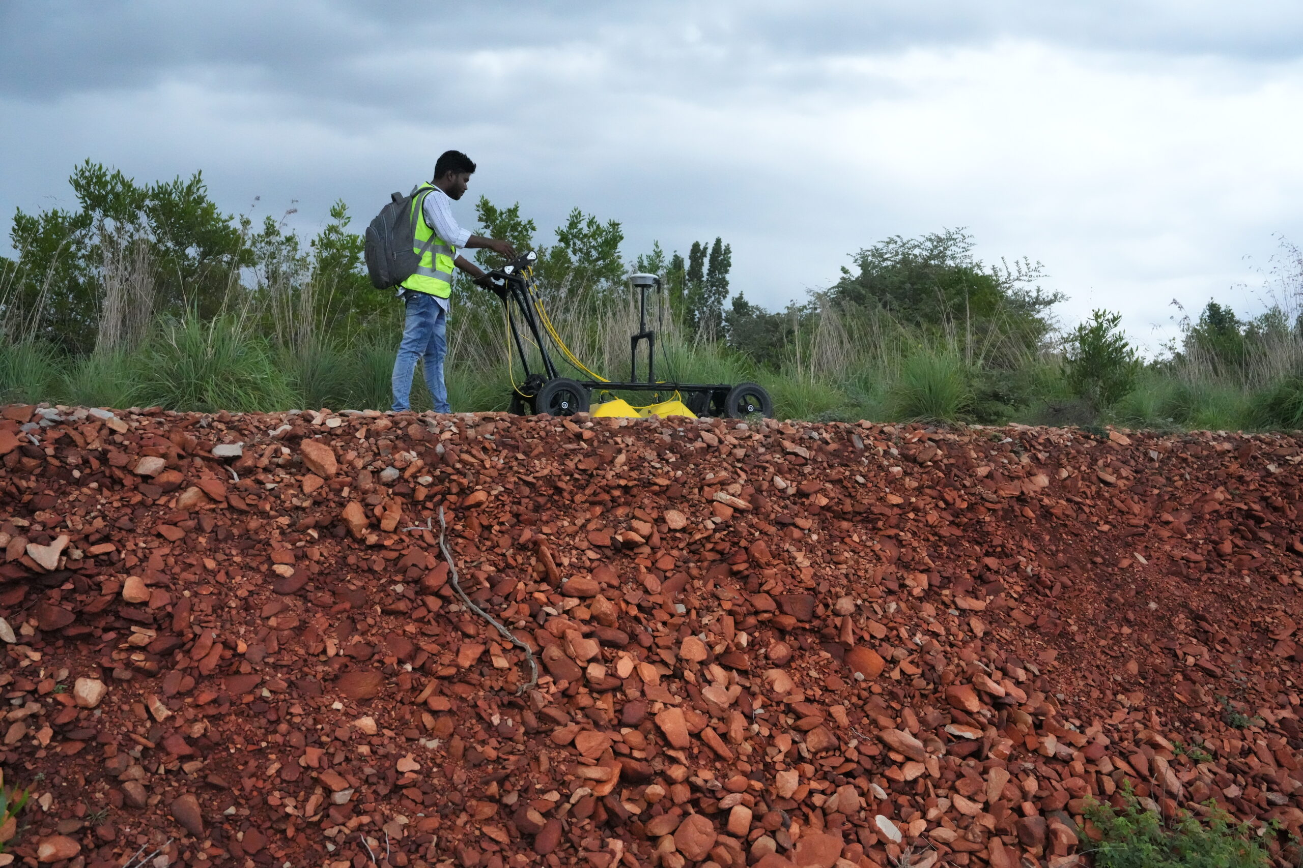
Regolith Thickness and Subsurface Characterization using GPR

Problem Statement Characterizing regolith layers is essential for understanding ground stability, soil–rock interactions, and construction suitability. Conventional borehole methods provide only point-specific information and often miss lateral variability. A non-invasive, high-resolution technique was required to map regolith thickness, detect lithological variations, and identify subsurface features such as boulders and air pockets near construction sites at…