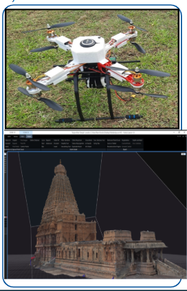
Dynamic Topographic Mapping Through Aerial Cartography With UAV-LIDAR Advancements , Paavai Engineering College Principal Investigator & Designation: Dr.R.Mohanapriya & Head of the Department , ECE
Breakthrough/World class work in the project:
To develop a consultancy model – Urban planning and Historical monument imaging.
Impact on the Country:
The UAV-LiDAR project enhances topographic mapping accuracy, boosting and accelerating infrastructure development - urban planning and other sectors.
Novel feature in the project:
- Integration of Unmanned Aerial Vehicles (UAVs) with Light Detection and Ranging (LiDAR) technology.
- Data Acquisition protocols
- AI and ML-based approaches for analysis of LiDAR data.